A teabreak in Texas
- maggiethompson56
- May 4, 2023
- 2 min read
Perhaps you know that I often use information gleaned from Google Earth and Streetview as the basis of my work. Sometimes though I just like looking at places without anything in mind, so the other day I decided to spend my tea break in Texas. Well, not actually in Texas, but looking at it.
I’ve been before, virtually that is, and I know that east of Amarillo there’s an area which fascinates me when I view it in satellite view. It’s an incredible patchwork of fields.

What you see from above are hundreds of circles, though from the ground on street view it’s not really interesting (I checked).
As you may also know my first degree (before I returned to study Fine Art as a mature student) was in Geography, and so I started thinking like a Geographer. All that irrigation, all that manipulation of the land. How important are those fields to the local economy? How has it been achieved, and at what environmental cost?
Because I’m in in that limbo that happens at the end of a big piece of work, the images I saw on my laptop fed into my return to the studio where I was playing around with materials, and made a few small plates.
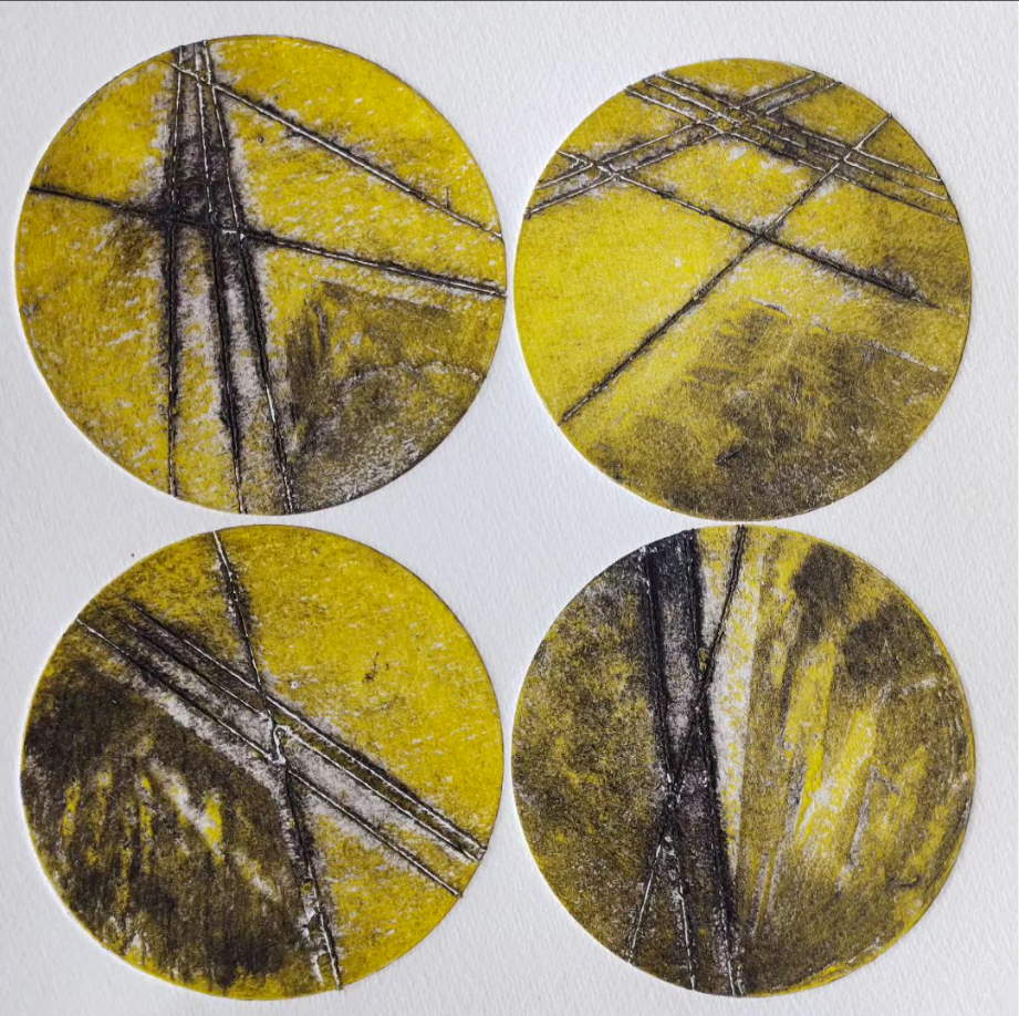
I guess the reason I made this print in yellow was because of the words of the song ‘Fields of Gold’ which was going round in my head while I was working, although I discover that the name Amarillo comes from the Spanish for the colour yellow and wondered if somewhere in my subconscious I knew that.
These fields only exist here, and only look like this, because of the irrigation that makes these crop circles with those massive long arms circling to spread water from a single central point.

It’s the irrigation that enables the agriculture to take place that much of Texas and a large proportion of the US depends upon it for its production of dairy products, beef and corn. But where does the water come from? Apparently it’s from the Ogallala Aquifer which is, I read, being used up at a rate far faster than it is being replenished. So the fact that the water used to irrigate is being depleted is a huge issue
But these are not ‘fields of gold’ in the way that I would usually think of them, not obviously fields of waving corn, their gold is economic. Irrigated agriculture accounts for $1.6 billion in the economy ( didn’t make a note of what year that was) and 16,650 jobs are associated with irrigation which at the time those figures were collected, amounted to 7½ % of all employment in the region.
But if the water is being used up, what happens then? This is such a fragile landscape and one which has only existed in this form for a short while.
So I start to think about how I might print these simple plates to get that point across, if indeed this is an idea I chose to work with.
Something to try out in the future.

Comments